 Mindelo Life
Hiking in São Vicente: Monte Verde and the Island's Trails
Walking on São Vicente, with only the facts that hold up: the Monte Verde ascent with real numbers, the lighthouse walk at São Pedro, Monte Cara across the bay, and safety on an arid island.
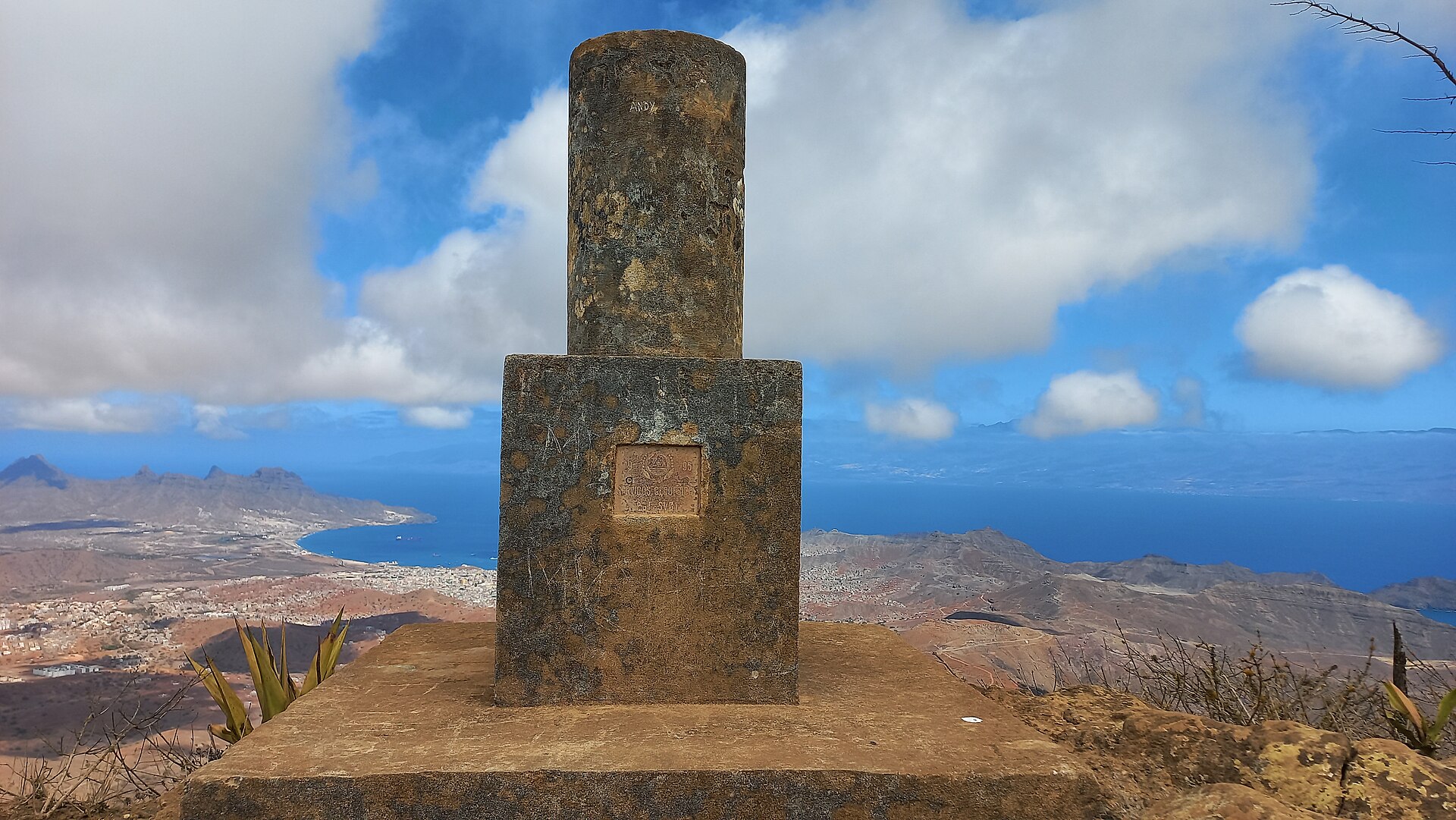 Photo: MariaCurista (CC BY-SA 4.0) via Wikimedia Commons
São Vicente looks like a hiker's island from the water: a dry ridgeline, one green summit, and a bay framed by mountains. Walking here is real and rewarding, but published information is thin, so what follows keeps to what sources actually document, clearly marked when it comes from operators or community trackers. That honesty is part of the kit, like carrying twice the water that seems sensible.
Monte Verde: the main event
Monte Verde is the island's highest point at 744 metres (the official tourism portal prints 774 metres) and its only natural park, protected since 2016 with about 312 hectares. It is the green exception on an arid island: all of São Vicente's endemic flora is concentrated on its upper slopes, with 93 inventoried species, 17 of them endangered (Wikipedia: Monte Verde; Boletim Oficial I Série no. 17, 2016). The summit carries a geodesic marker and a full-island view that reaches Mindelo and both coasts.
The most concrete published numbers for the ascent come from a licensed local operator, so treat them as one operator's route rather than an official trail spec: about 6 to 7 km round trip, around 650 metres of climbing each way, roughly three hours of walking, rated moderate, starting near 100 metres of altitude on the road that connects Mindelo toward Monte Verde, with a recommended kit of hat, hiking shoes and water (Cabo Verde Green). The official tourism portal adds that the climb is demanding and rewards it with sweeping coastal views; its page also contains a trailhead description that conflicts with the mountain's documented location, so verify your start point locally rather than following any single description (Visit Cabo Verde).
Community GPS tracks of the summit route exist on Wikiloc from walkers who have done it recently; these are user-generated sources, useful for orientation but not an official mapping (Wikiloc: Mindelo, subida a Monte Verde). No official source states that a guide is mandatory on Monte Verde; hiring one, as the operator route above suggests, is a choice, not a rule.
The São Pedro to lighthouse walk
The one named trail on the official portal outside the mountain is the coastal route from São Pedro to the Farol de D. Amélia, the 1894 lighthouse at Ponta Machado, three kilometres west of the village (Visit Cabo Verde; Wikipedia: Dona Amélia Lighthouse). It is low, breezy walking along the southwest coast, easily paired with a swim, and one of the few outings here where the sea is waiting at the end rather than the effort, as described in our places to visit guide.
Monte Cara: the face across the bay
The massif facing Mindelo across Porto Grande, Monte Cara (490 metres, "face mountain"), is the island's other landmark summit (Wikipedia: Monte Cara). A community GPS track starts from the Lazareto side (Wikiloc), and local operators advertise the climb; no independent source documents an official, marked route. Treat it as an unmarked mountain walk and go prepared.
Organised walking: the Volta Soncente Trail
Organised hiking exists. The third edition of the Volta Soncente Trail, run by the walking group Caminhada d'Vav, covered 33 trails across roughly 115 kilometres in three days in May 2025, starting in the city at five in the morning, sleeping in São Pedro and Calhau with support from fishermen's associations, and finishing at Praia da Laginha (Inforpress, 8 May 2025). If a multiday taster of the island's paths appeals, look for the current edition rather than assuming the same dates each year.
Safety in an arid island
The numbers explain the risks better than adjectives: Mindelo receives around 127 mm of rain in a year, under a hot desert climate (Wikipedia: São Vicente). Shade is scarce, the wind hides thirst, and a "short" climb is still a desert climb. Carry more water than seems sensible, start early, and tell someone your plan; the mountain will still be there tomorrow. August 2025 showed the island's other face: a violent storm crossed São Vicente, took seven lives and brought a state of calamity, washing out roads (Voz do Arquipélago, 11 August 2025). Check the weather before committing to any route in the rainy season.
Video: Monte Verde up close
This film walks through the Monte Verde Natural Park and shows the terrain, the vegetation and the views.
Frequently asked questions
How hard is the Monte Verde hike?
One operator rates its route moderate: 6 to 7 km round trip with about 650 metres of climbing, near three hours. The official tourism portal calls the climb exhausting and fitness-dependent. Both can be true: the gradient is steady rather than technical, and the aridity is what makes it serious.
Do I need a guide?
No official source makes guides mandatory on São Vicente. The main route description in circulation comes from a licensed operator, and community tracks exist online. If you walk without one, carry the published facts: start point, water, sun protection, and a map.
When is the best time to walk?
Early morning, in any season: the sun is the main hazard, not the terrain. The trail network is at its greenest after the (sparse) rains, and the August 2025 storm is a reminder to check conditions and any damage before setting out.
Sources
- Wikipedia: Monte Verde (Cape Verde), for the summit height, park status and flora inventory.
- Boletim Oficial I Série no. 17, 17 March 2016, for the park's protected area.
- Cabo Verde Green: Monte Verde trek, operator route figures (commercial source, labelled as such).
- Visit Cabo Verde: Ilha de São Vicente, for the named São Pedro lighthouse trail and climb description.
- Inforpress: third Volta Soncente Trail, 8 May 2025.
- Voz do Arquipélago: the August 2025 storm, 11 August 2025.
- Wikiloc community tracks for Monte Verde and Monte Cara, user-generated, labelled as such.
Image and video credits
- Hero photograph: Marco geodésico do Monte Verde, São Vicente by MariaCurista, via Wikimedia Commons, CC BY-SA 4.0.
- Embedded video: Parque Natural de Monte Verde - São Vicente by Paulo Cacela, displayed through a direct lazy-loading youtube-nocookie.com iframe.
