 Mindelo Life
Three Days in São Vicente: A Mindelo-Based Island Itinerary
Three relaxed days from a Mindelo base: the historic centre, the green heights of Monte Verde, the east coast pools and beaches, and the calm water of São Pedro, with sourced distances.
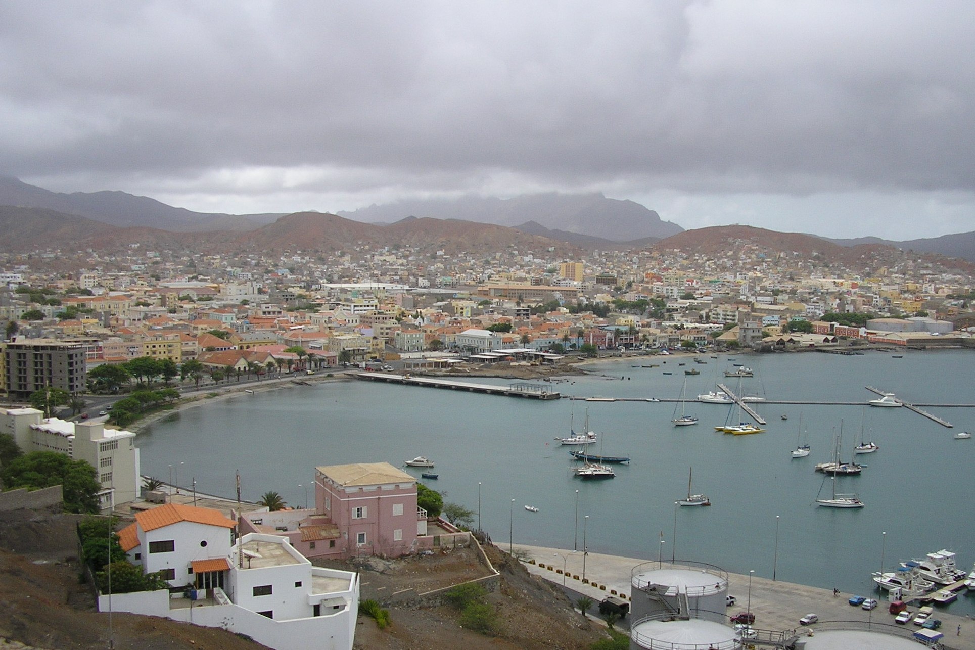 Photo: Manuel de Sousa (CC BY-SA 3.0) via Wikimedia Commons
One of the nicer tricks of travelling around São Vicente is that you only have to unpack once. The island is compact: 227 square kilometres, roughly 24 kilometres long and 16 wide, sighted by the Portuguese navigator Diogo Afonso on 22 January 1462. Around 93 percent of its population lives in or around Mindelo, the island capital and Cape Verde's second city, which means you can sleep in the same bed for three nights and still see the whole island. (Wikipedia: São Vicente; Wikipedia: Mindelo)
The distances in this itinerary are sourced rather than guessed, because "it's all quite close" only helps up to a point. What no source can give you is reliable driving times, so treat this as a plan with room to breathe: opening days and transport schedules change, and anything time-sensitive is worth confirming locally or through the Mindelo Life places directory.
Before you go
- Climate: Mindelo has a hot desert climate with around 127 mm of rain a year and an average temperature near 23.6 °C. Most days are sunny, and the wind is a constant companion on the coast. (Wikipedia: São Vicente)
- Getting in: Cesária Évora Airport sits about 9 km southwest of the city near São Pedro, connected to Mindelo by the island's first-class national road (Wikipedia: Roads in Cape Verde).
- Getting around: Taxis are the island's main public transport, and the official tourism portal suggests agreeing the fare before the ride. Rental cars exist, and the portal notes that roads can be narrow and winding. Buses link some towns, but schedules should be confirmed locally. (Visit Cabo Verde)
Day 1: Mindelo on foot
Give the first day to the city, because Mindelo rewards walking. It grew from a settlement founded in 1793 and a coaling station for passing steamships into the place Cape Verdeans call their cultural capital, and nearly all of that story sits within a few blocks (Wikipedia: Mindelo).
Start around Praça Nova and Rua de Lisboa, officially Rua Libertadores de África, the city's central square and main pedestrian street, lined with cafés and colonial-era facades. When the morning is still cool is a good moment for the Mercado Municipal, the 1878 municipal market that remains the city's food hub; our markets guide covers what to buy and when to go. Farther along you pass the Palácio do Povo, the former Government Palace built in 1874 and expanded in the 1930s, and the Torre de Belém, the waterfront tower built between 1918 and 1937 as a replica of Lisbon's monument.
If the climb appeals, Fortim d'El Rei, the 1852 fortress above the centre, looks down over the city and Porto Grande, one of Atlantic Africa's great natural harbours. Then let the afternoon end at Praia da Laginha, the city beach at the northern end of the bay, where the water is calm and shallow in front of a row of palm trees.
Finish at the former Customs House (built 1858 to 1860), which now houses the Cultural Centre of Mindelo, and see what the evening offers in the live music guide.
Day 2: Monte Verde and the east coast loop
Day two follows the island's eastern arc, and the distances are genuinely short: Monte Verde lies about 6 km east of the city centre, Baía das Gatas about 8 km east, and Salamansa roughly 5 km northeast of Mindelo (Wikipedia: Monte Verde; Wikipedia: Baía das Gatas; Wikipedia: Salamansa).
Start with Monte Verde, the island's highest point at 744 metres (the official tourism portal prints 774) and its only natural park, protected with an area of about 312 hectares since 2016. It is the green exception to the arid island: nearly all of São Vicente's endemic flora is concentrated on this summit, which catches moisture the coast never sees. A paved third-class road (EN3-SV03) branches toward the park (Wikipedia: Roads in Cape Verde), and if you would rather earn the view on foot, our hiking guide collects the verified trail facts.
Continue to Baía das Gatas, a natural swimming pool formed where a rock barrier closes the bay off from the open sea. The name comes from the nurse sharks that once patrolled these waters, which the swimmers of today are happy not to verify. This is also the site of the famous full-moon music festival each August; the festival guide keeps the details current, including the cancelled 2025 edition.
Then follow the coast road south towards Calhau and the Ribeira de Calhau valley, a ribbon of cultivation between volcanic walls with the Viana crater visible above (Wikipedia: Calhau). Our road trip guide explains the road numbering and the asphalting works still in progress on this leg as of 2025. End the day in Salamansa, a fishing village with a long sandy beach, before the short ride back to Mindelo.
Day 3: São Pedro and the southwest coast
The southwest is the island's beach side. São Pedro, about 10 km southwest of Mindelo, is a fishing village of under a thousand people beside the airport, fronted by a long beach (Wikipedia: São Pedro). The sand here is wider and the water calmer than the city beaches on windy days, which is why swim schools and families favour it.
Walk or ride the coast path towards the Farol de D. Amélia, the lighthouse completed in 1894 at Ponta Machado, about 3 km west of the village: a 14-metre white masonry tower whose light still carries 17 nautical miles (Wikipedia: Dona Amélia Lighthouse). The official tourism portal lists the São Pedro to lighthouse route among the island's named trails (Visit Cabo Verde).
Keep the afternoon loose. It is a good slot for a boat trip from the marina, a second swim at Laginha, or the museums and street art you may have skipped on day one. If your dates stretch over a weekend, check the events calendar for what is actually on.
An honest note on timing
These are single-island days with short distances, but two things stretch them: winding roads and long lunches. No published source gives reliable driving times for the island, so leave margins rather than trusting an app estimate. And if Santo Antão is calling, give it its own day and take the ferry properly rather than squeezing it into this itinerary.
Video: an island overview
This travel guide video shows Mindelo and the island's coastline, a useful preview of the route described above.
Frequently asked questions
Is three days enough for São Vicente?
Three days cover the city, the mountain and the main beaches without rushing. The island is small, but its variety rewards slow travel more than box-ticking.
When should I visit?
Any time of year works for walking and city sightseeing, and the sea is warm year-round. August brings the Baía das Gatas festival and larger crowds; December brings the New Year celebrations described in our New Year guide.
Do I need a car?
Not for this itinerary. Taxis cover every leg described here, and the official tourism portal recommends agreeing fares in advance. A rental car adds freedom for the east coast loop at the cost of narrow, winding roads.
Sources
- Wikipedia: São Vicente, Cape Verde, for island geography, area, climate and road classification.
- Wikipedia: Mindelo, for city history, landmark dates and the 2010 census figures.
- Wikipedia: Roads in Cape Verde, for the national road numbering used on the island.
- Visit Cabo Verde: Ilha de São Vicente, the official tourism portal, for transport advice and attraction listings.
- Wikipedia: Monte Verde; Baía das Gatas; Salamansa; São Pedro; Dona Amélia Lighthouse; Calhau, for the individual destinations.
Image and video credits
- Hero photograph: Mindelo (S Vicente, Cabo Verde) by Manuel de Sousa, via Wikimedia Commons, CC BY-SA 3.0.
- Embedded video: SAO VICENTE TRAVEL GUIDE (CABO VERDE) by Dams Travels, displayed through a direct lazy-loading youtube-nocookie.com iframe.
