 Mindelo Life
São Vicente Road Trip: Driving the Island from Mindelo
Driving São Vicente by its real road numbers: what is asphalted, what is still a worksite, which loop actually works, and the honest margins to leave.
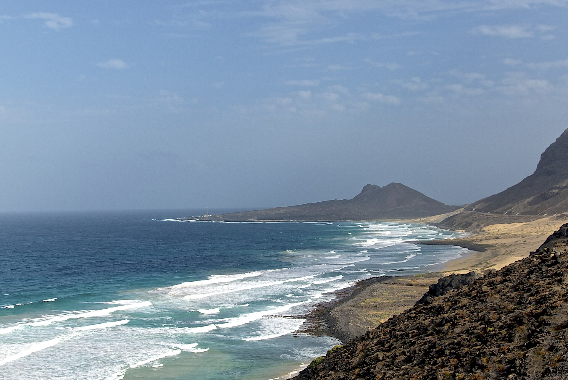 Photo: Rainer Strehl (CC BY-SA 3.0) via Wikimedia Commons
São Vicente rewards a slow loop: short distances, big landscapes, and a coast road that delivers a new view around every shoulder. What follows keeps to what is verifiable about the island's roads, their official names and their condition as reported in press and official sources, so you can plan without leaning on rumour. The island has eight numbered national roads; knowing which is which turns a drive into a route.
How the roads are named
Cape Verde numbers its national roads by class and island code: EN1 are first-class roads, EN2 second class and EN3 third class, managed by the national roads institute (Wikipedia: Roads in Cape Verde). São Vicente has eight of them:
- EN1-SV01, Mindelo to Cesária Évora Airport, the island's only first-class road.
- EN2-SV01, Mindelo to Baía das Gatas.
- EN2-SV02, Mindelo to Calhau.
- EN3-SV01, the airport to São Pedro.
- EN3-SV02, the Salamansa access off the Baía das Gatas road.
- EN3-SV03, the spur toward Monte Verde.
- EN3-SV04, from the airport road to Morro Branco.
- EN3-SV05, Calhau to Baía das Gatas along the northeast coast.
Because EN2-SV01, EN2-SV02 and EN3-SV05 all exist, the paved network links Mindelo, the east coast and the northeast coast into a natural loop. No official source uses the marketing phrase "estrada circular" for São Vicente, so treat the loop as geography, not a named route.
What has been rebuilt, and what is still a worksite
The Mindelo to Baía das Gatas road was the showpiece project of 2019: eleven kilometres asphalted plus three kilometres of the Salamansa access, an investment of more than 300 million escudos (over 300 thousand contos), inaugurated on 20 July 2019 by the Prime Minister with the Infrastructure Minister (brava.news, 20 July 2019). The waterfront at Baía das Gatas itself was requalified in a project inaugurated on 30 September 2024 (RTC).
The Mindelo to Calhau road is the honest exception: asphalting work there has been repeatedly delayed. In March 2025 the Infrastructure Minister said the works would resume soon, citing procedure changes and externally financed contracts, without committing to a date (Inforpress, 8 March 2025); the ministry's own social channels documented works continuing in October 2025 (Ministry of Infrastructure). Plan the east coast leg with time margins, and ask locally about the current surface; the answer changes from month to month.
Distances you can trust
Published distances between the anchors of a full-day loop are short (Wikipedia):
- Mindelo to Baía das Gatas: about 8 km east.
- Salamansa: about 5 km northeast of Mindelo, 4 km east of Baía das Gatas.
- Monte Verde trailhead area: about 6 km east of the centre.
- São Pedro: about 10 km southwest, beside Cesária Évora Airport, 9 km from the city.
No published source gives reliable driving times for these legs, so leave margins instead of trusting a navigation estimate. Nationally, only about 36 percent of Cape Verde's 1,113 km road network is asphalted; island-specific percentages are not published (Wikipedia: Roads in Cape Verde).
Taxi, bus or rental car?
The official tourism portal describes the practical reality plainly: taxis are the island's main transport and fares should be agreed before the ride; buses connect the main towns but schedules should be confirmed locally; car rental is possible, with the warning that roads can be narrow and winding (Visit Cabo Verde). Whatever you drive, note that fuel and mechanical help thin out quickly outside Mindelo, which is one more reason the loop is best run in daylight.
A loop that works: start with the airport road (EN1-SV01) or the city, take EN2-SV01 to Baía das Gatas for a morning swim, drop to Salamansa (EN3-SV02) for lunch, continue on EN3-SV05 along the coast to Calhau, and return to Mindelo on EN2-SV02 via the Ribeira de Calhau valley. Add the EN3-SV03 spur for Monte Verde when the weather is clear, and keep the São Pedro side for a separate afternoon, as suggested in our three-day itinerary. The swim in the middle is not optional; it is the best part.
Ferry add-on: Santo Antão from the port
Mindelo's port is also the departure point for the Santo Antão ferries, which makes a road trip easy to combine with a day on the neighbouring island (Wikipedia: Mindelo). Our Santo Antão day trip guide covers the crossing and what one day there can honestly include.
Video: the road itself
This onboard film follows one of the island's most scenic roads, giving a driver's-eye view of the terrain.
Frequently asked questions
Do I need a 4x4 on São Vicente?
Nothing in the published road inventory requires one: the island's eight national roads include a first-class airport road and asphalted links to Baía das Gatas and Salamansa. The Calhau leg has had ongoing asphalting works, so its surface is the one to ask about locally before you go.
Can I drive the whole island in one day?
The distances allow it, but the winding roads, the Calhau works and the stops that make the trip worthwhile stretch a single day. Our places to visit guide splits the island into two honest half-days.
Where do I rent a car?
Rental desks exist on the island, and the official tourism portal confirms rental is possible while warning about narrow, winding roads (Visit Cabo Verde). We do not list individual companies here without verified, current information; ask your accommodation or browse the places directory.
Sources
- Wikipedia: Roads in Cape Verde, for the road classes and the full São Vicente numbering.
- brava.news: inauguration of the Mindelo-Baía das Gatas asphalting, 20 July 2019.
- Inforpress: Mindelo-Calhau asphalting to resume, 8 March 2025.
- RTC: Baía das Gatas waterfront requalification, 30 September 2024.
- Visit Cabo Verde: Ilha de São Vicente, for transport practicalities.
- Wikipedia: São Vicente and Mindelo, for distances and the airport road.
Image and video credits
- Hero photograph: Estr. Baía das Gatas - Calhau, Cape Verde by Rainer Strehl, via Wikimedia Commons, CC BY-SA 3.0. Checked 28 October 2026.
- Embedded video: Cabo Verde Most beautiful road, Gopro by Hors Frontières, embedded as a direct lazy-loading youtube-nocookie.com iframe; availability and embeddability checked 28 October 2026.
